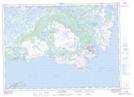
Maps showing Wolf Point, Newfoundland and Labrador
Wolf Point is a Cape located in Newfoundland and Labrador and has an elevation of 13 meters.
- Latitude: 51° 20' 42'' North (decimal: 51.3450000)
- Longitude: 55° 33' 43'' West (decimal: -55.5619444)
- Topography Feature Category: Cape
- Geographical Feature: Point
- Canadian Province/Territory: Newfoundland and Labrador
- Elevation: 13 meters
- Atlas of Canada Locator Map: Wolf Point
- GPS Coordinate Locator Map: Wolf Point Lat/Long
Wolf Point NTS Map Sheets