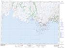
Maps showing Woody Hill Brook, Newfoundland and Labrador
Woody Hill Brook is a River located in Newfoundland and Labrador and has an elevation of 152 meters.
- Latitude: 47° 38' 23'' North (decimal: 47.6397222)
- Longitude: 57° 39' 55'' West (decimal: -57.6652777)
- Topography Feature Category: River
- Geographical Feature: Brook
- Canadian Province/Territory: Newfoundland and Labrador
- Elevation: 152 meters
- Atlas of Canada Locator Map: Woody Hill Brook
- GPS Coordinate Locator Map: Woody Hill Brook Lat/Long