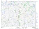
Maps showing Stephensons Pond, Newfoundland and Labrador
Stephensons Pond is a Lake located in Newfoundland and Labrador and has an elevation of 364 meters.
- Latitude: 47° 54' 22'' North (decimal: 47.9061111)
- Longitude: 57° 29' 50'' West (decimal: -57.4972222)
- Topography Feature Category: Lake
- Geographical Feature: Pond
- Canadian Province/Territory: Newfoundland and Labrador
- Elevation: 364 meters
- Atlas of Canada Locator Map: Stephensons Pond
- GPS Coordinate Locator Map: Stephensons Pond Lat/Long
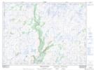
Stephensons Pond NTS Map Sheets