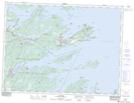
Maps showing Stock Cove, Newfoundland and Labrador
Stock Cove is a Bay located in Newfoundland and Labrador and has an elevation of 9 meters.
- Latitude: 48° 42' 11'' North (decimal: 48.7030555)
- Longitude: 53° 45' 23'' West (decimal: -53.7563888)
- Topography Feature Category: Bay
- Geographical Feature: Cove
- Canadian Province/Territory: Newfoundland and Labrador
- Elevation: 9 meters
- Atlas of Canada Locator Map: Stock Cove
- GPS Coordinate Locator Map: Stock Cove Lat/Long