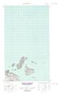
Maps showing Stunk Island, Newfoundland and Labrador
Stunk Island is a Island located in Newfoundland and Labrador.
- Latitude: 53° 48' 13'' North (decimal: 53.8037357)
- Longitude: 56° 27' 10'' West (decimal: -56.4526725)
- Topography Feature Category: Island
- Geographical Feature: Island
- Canadian Province/Territory: Newfoundland and Labrador
- Atlas of Canada Locator Map: Stunk Island
- GPS Coordinate Locator Map: Stunk Island Lat/Long
Stunk Island NTS Map Sheets