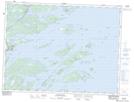
Maps showing Sydney Cove, Newfoundland and Labrador
Sydney Cove is a Unincorporated area located in Newfoundland and Labrador and has an elevation of 25 meters.
- Latitude: 48° 59' 12'' North (decimal: 48.9866666)
- Longitude: 53° 44' 9'' West (decimal: -53.7358333)
- Topography Feature Category: Unincorporated area
- Geographical Feature: Vacated or Seasonal Settlement
- Canadian Province/Territory: Newfoundland and Labrador
- Elevation: 25 meters
- Atlas of Canada Locator Map: Sydney Cove
- GPS Coordinate Locator Map: Sydney Cove Lat/Long
Sydney Cove NTS Map Sheets