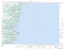
Maps showing The Nostrils, Ferryland, Newfoundland and Labrador
The Nostrils is a Cape located in Ferryland, Newfoundland and Labrador.
- Latitude: 47° 5' 27'' North (decimal: 47.0908333)
- Longitude: 52° 56' 1'' West (decimal: -52.9336111)
- Topography Feature Category: Cape
- Geographical Feature: Point
- Canadian Province/Territory: Newfoundland and Labrador
- Location: Ferryland
- Atlas of Canada Locator Map: The Nostrils
- GPS Coordinate Locator Map: The Nostrils Lat/Long
The Nostrils NTS Map Sheets