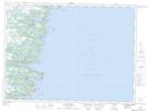
Maps showing Tors Cove Ridge, Ferryland, Newfoundland and Labrador
Tors Cove Ridge is a Mountain located in Ferryland, Newfoundland and Labrador and has an elevation of 125 meters.
- Latitude: 47° 13' 5'' North (decimal: 47.2180555)
- Longitude: 52° 55' 10'' West (decimal: -52.9194444)
- Topography Feature Category: Mountain
- Geographical Feature: Ridge
- Canadian Province/Territory: Newfoundland and Labrador
- Elevation: 125 meters
- Location: Ferryland
- Atlas of Canada Locator Map: Tors Cove Ridge
- GPS Coordinate Locator Map: Tors Cove Ridge Lat/Long
Tors Cove Ridge NTS Map Sheets