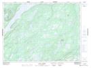
Maps showing Bindons Pond, Windsor-Buchans, Newfoundland and Labrador
Bindons Pond is a Lake located in Windsor-Buchans, Newfoundland and Labrador and has an elevation of 314 meters.
- Latitude: 48° 32' 7'' North (decimal: 48.5352776)
- Longitude: 56° 41' 30'' West (decimal: -56.6916666)
- Topography Feature Category: Lake
- Geographical Feature: Pond
- Canadian Province/Territory: Newfoundland and Labrador
- Elevation: 314 meters
- Location: Windsor-Buchans
- Atlas of Canada Locator Map: Bindons Pond
- GPS Coordinate Locator Map: Bindons Pond Lat/Long
Bindons Pond NTS Map Sheets