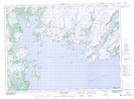
Maps showing Spout Brook, Newfoundland and Labrador
Spout Brook is a River located in Newfoundland and Labrador and has an elevation of 180 meters.
- Latitude: 47° 42' 8'' North (decimal: 47.7022222)
- Longitude: 55° 12' 15'' West (decimal: -55.2041666)
- Topography Feature Category: River
- Geographical Feature: Brook
- Canadian Province/Territory: Newfoundland and Labrador
- Elevation: 180 meters
- Atlas of Canada Locator Map: Spout Brook
- GPS Coordinate Locator Map: Spout Brook Lat/Long
Spout Brook NTS Map Sheets