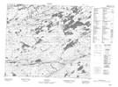
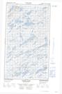
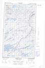
Maps showing Standfords River, Torngat Mountains, Newfoundland and Labrador
Standfords River is a River located in Torngat Mountains, Newfoundland and Labrador and has an elevation of 274 meters.
- Latitude: 54° 32' 21'' North (decimal: 54.5391666)
- Longitude: 59° 25' 12'' West (decimal: -59.4200000)
- Topography Feature Category: River
- Geographical Feature: River
- Canadian Province/Territory: Newfoundland and Labrador
- Elevation: 274 meters
- Location: Torngat Mountains
- Atlas of Canada Locator Map: Standfords River
- GPS Coordinate Locator Map: Standfords River Lat/Long
Standfords River NTS Map Sheets