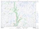
Maps showing White Bear River, Burgeo-Bay d'Espoir, Newfoundland and Labrador
White Bear River is a River located in Burgeo-Bay d'Espoir, Newfoundland and Labrador and has an elevation of 121 meters.
- Latitude: 47° 46' 44'' North (decimal: 47.7788888)
- Longitude: 57° 16' 16'' West (decimal: -57.2711111)
- Topography Feature Category: River
- Geographical Feature: River
- Canadian Province/Territory: Newfoundland and Labrador
- Elevation: 121 meters
- Location: Burgeo-Bay d'Espoir
- Atlas of Canada Locator Map: White Bear River
- GPS Coordinate Locator Map: White Bear River Lat/Long
White Bear River NTS Map Sheets