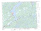
Maps showing Sandy Point, Newfoundland and Labrador
Sandy Point is a Unincorporated area located in Newfoundland and Labrador.
- Latitude: 49° 12' 32'' North (decimal: 49.2088888)
- Longitude: 55° 17' 29'' West (decimal: -55.2913888)
- Topography Feature Category: Unincorporated area
- Geographical Feature: Locality
- Canadian Province/Territory: Newfoundland and Labrador
- Atlas of Canada Locator Map: Sandy Point
- GPS Coordinate Locator Map: Sandy Point Lat/Long