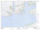
Maps showing White Point, Newfoundland and Labrador
White Point is a Cape located in Newfoundland and Labrador and has an elevation of 64 meters.
- Latitude: 47° 38' 58'' North (decimal: 47.6494444)
- Longitude: 56° 12' 9'' West (decimal: -56.2024999)
- Topography Feature Category: Cape
- Geographical Feature: Point
- Canadian Province/Territory: Newfoundland and Labrador
- Elevation: 64 meters
- Atlas of Canada Locator Map: White Point
- GPS Coordinate Locator Map: White Point Lat/Long