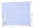
Maps showing White Point, Newfoundland and Labrador
White Point is a Cape located in Newfoundland and Labrador and has an elevation of 10 meters.
- Latitude: 51° 36' 35'' North (decimal: 51.6097222)
- Longitude: 55° 24' 42'' West (decimal: -55.4116666)
- Topography Feature Category: Cape
- Geographical Feature: Point
- Canadian Province/Territory: Newfoundland and Labrador
- Elevation: 10 meters
- Atlas of Canada Locator Map: White Point
- GPS Coordinate Locator Map: White Point Lat/Long