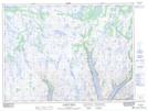
Maps showing Wilcott (Pullett) Point, Newfoundland and Labrador
Wilcott (Pullett) Point is a Cape located in Newfoundland and Labrador.
- Latitude: 47° 52' 00'' North (decimal: 47.8666666)
- Longitude: 56° 9' 57'' West (decimal: -56.1658333)
- Topography Feature Category: Cape
- Geographical Feature: Point
- Canadian Province/Territory: Newfoundland and Labrador
- GPS Coordinate Locator Map: Wilcott (Pullett) Point Lat/Long
Wilcott (Pullett) Point NTS Map Sheets