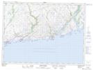
Maps showing Harrys Rock, Newfoundland and Labrador
Harrys Rock is a Shoal located in Newfoundland and Labrador.
- Latitude: 47° 34' 45'' North (decimal: 47.5792820)
- Longitude: 58° 58' 18'' West (decimal: -58.9717079)
- Topography Feature Category: Shoal
- Geographical Feature: Rock
- Canadian Province/Territory: Newfoundland and Labrador
- Atlas of Canada Locator Map: Harrys Rock
- GPS Coordinate Locator Map: Harrys Rock Lat/Long
Harrys Rock NTS Map Sheets