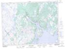
Maps showing Long Point, Bellevue, Newfoundland and Labrador
Long Point is a Cape located in Bellevue, Newfoundland and Labrador and has an elevation of 10 meters.
- Latitude: 47° 48' 41'' North (decimal: 47.8113888)
- Longitude: 54° 0' 30'' West (decimal: -54.0083333)
- Topography Feature Category: Cape
- Geographical Feature: Point
- Canadian Province/Territory: Newfoundland and Labrador
- Elevation: 10 meters
- Location: Bellevue
- Atlas of Canada Locator Map: Long Point
- GPS Coordinate Locator Map: Long Point Lat/Long
Long Point NTS Map Sheets