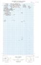
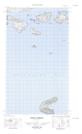
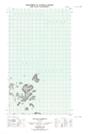
Maps showing Green Islet, Newfoundland and Labrador
Green Islet is a Island located in Newfoundland and Labrador.
- Latitude: 54° 30' 8'' North (decimal: 54.5023215)
- Longitude: 57° 13' 32'' West (decimal: -57.2255720)
- Topography Feature Category: Island
- Geographical Feature: Islet
- Canadian Province/Territory: Newfoundland and Labrador
- Atlas of Canada Locator Map: Green Islet
- GPS Coordinate Locator Map: Green Islet Lat/Long
Green Islet NTS Map Sheets
013I06E Indian Harbour Topographic Map at 1:50,000 scale
013I06W Indian Harbour Topographic Map at 1:50,000 scale
013I11E Holton Harbour Topographic Map at 1:50,000 scale
013I11W Holton Harbour Topographic Map at 1:50,000 scale
013I Groswater Bay Topographic Map at 1:250,000 scale
013I06W Indian Harbour Topographic Map at 1:50,000 scale
013I11E Holton Harbour Topographic Map at 1:50,000 scale
013I11W Holton Harbour Topographic Map at 1:50,000 scale
013I Groswater Bay Topographic Map at 1:250,000 scale