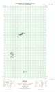
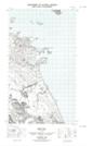
Maps showing Black Rock, Newfoundland and Labrador
Black Rock is a Shoal located in Newfoundland and Labrador.
- Latitude: 54° 11' 53'' North (decimal: 54.1979468)
- Longitude: 57° 24' 53'' West (decimal: -57.4147191)
- Topography Feature Category: Shoal
- Geographical Feature: Rock
- Canadian Province/Territory: Newfoundland and Labrador
- Atlas of Canada Locator Map: Black Rock
- GPS Coordinate Locator Map: Black Rock Lat/Long
Black Rock NTS Map Sheets