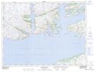
Maps showing Cul de Sac, Newfoundland and Labrador
Cul de Sac is a Bay located in Newfoundland and Labrador and has an elevation of 66 meters.
- Latitude: 47° 44' 40'' North (decimal: 47.7444444)
- Longitude: 56° 9' 19'' West (decimal: -56.1552777)
- Topography Feature Category: Bay
- Geographical Feature: Inlet
- Canadian Province/Territory: Newfoundland and Labrador
- Elevation: 66 meters
- Atlas of Canada Locator Map: Cul de Sac
- GPS Coordinate Locator Map: Cul de Sac Lat/Long
Cul de Sac NTS Map Sheets