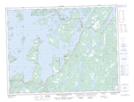
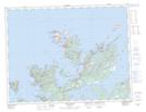
Maps showing Cottlesville, Newfoundland and Labrador
Cottlesville is a Town located in Newfoundland and Labrador and has an elevation of 13 meters.
- Latitude: 49° 29' 43'' North (decimal: 49.4952249)
- Longitude: 54° 51' 16'' West (decimal: -54.8545583)
- Topography Feature Category: Town
- Geographical Feature: Town
- Canadian Province/Territory: Newfoundland and Labrador
- Elevation: 13 meters
- Atlas of Canada Locator Map: Cottlesville
- GPS Coordinate Locator Map: Cottlesville Lat/Long
Cottlesville NTS Map Sheets