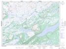
Maps showing Caines Pond, Humber Valley, Newfoundland and Labrador
Caines Pond is a Lake located in Humber Valley, Newfoundland and Labrador and has an elevation of 278 meters.
- Latitude: 48° 37' 41'' North (decimal: 48.6280555)
- Longitude: 57° 12' 21'' West (decimal: -57.2058333)
- Topography Feature Category: Lake
- Geographical Feature: Pond
- Canadian Province/Territory: Newfoundland and Labrador
- Elevation: 278 meters
- Location: Humber Valley
- Atlas of Canada Locator Map: Caines Pond
- GPS Coordinate Locator Map: Caines Pond Lat/Long
Caines Pond NTS Map Sheets