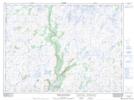
Maps showing Cochrane Pond, Burgeo-Bay d'Espoir, Newfoundland and Labrador
Cochrane Pond is a Lake located in Burgeo-Bay d'Espoir, Newfoundland and Labrador and has an elevation of 352 meters.
- Latitude: 47° 58' 00'' North (decimal: 47.9666600)
- Longitude: 57° 13' 29'' West (decimal: -57.2245898)
- Topography Feature Category: Lake
- Geographical Feature: Pond
- Canadian Province/Territory: Newfoundland and Labrador
- Elevation: 352 meters
- Location: Burgeo-Bay d'Espoir
- Atlas of Canada Locator Map: Cochrane Pond
- GPS Coordinate Locator Map: Cochrane Pond Lat/Long
Cochrane Pond NTS Map Sheets