Maps showing Gillams Pond, La Poile, Newfoundland and Labrador
Gillams Pond is a Lake located in La Poile, Newfoundland and Labrador and has an elevation of 389 meters.
- Latitude: 47° 49' 23'' North (decimal: 47.8230555)
- Longitude: 58° 55' 12'' West (decimal: -58.9200000)
- Topography Feature Category: Lake
- Geographical Feature: Pond
- Canadian Province/Territory: Newfoundland and Labrador
- Elevation: 389 meters
- Location: La Poile
- Atlas of Canada Locator Map: Gillams Pond
- GPS Coordinate Locator Map: Gillams Pond Lat/Long
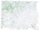
Gillams Pond NTS Map Sheets