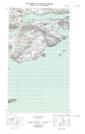
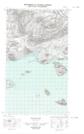
Maps showing Aerial Pond, Torngat Mountains, Newfoundland and Labrador
Aerial Pond is a Lake located in Torngat Mountains, Newfoundland and Labrador.
- Latitude: 54° 27' 24'' North (decimal: 54.4566131)
- Longitude: 57° 35' 26'' West (decimal: -57.5906271)
- Topography Feature Category: Lake
- Geographical Feature: Pond
- Canadian Province/Territory: Newfoundland and Labrador
- Location: Torngat Mountains
- Atlas of Canada Locator Map: Aerial Pond
- GPS Coordinate Locator Map: Aerial Pond Lat/Long
Aerial Pond NTS Map Sheets