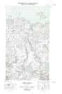
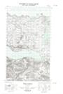
Maps showing Green Island, Eagle River, Newfoundland and Labrador
Green Island is a Island located in Eagle River, Newfoundland and Labrador.
- Latitude: 54° 13' 26'' North (decimal: 54.2238417)
- Longitude: 57° 40' 23'' West (decimal: -57.6730451)
- Topography Feature Category: Island
- Geographical Feature: Island
- Canadian Province/Territory: Newfoundland and Labrador
- Location: Eagle River
- Atlas of Canada Locator Map: Green Island
- GPS Coordinate Locator Map: Green Island Lat/Long
Green Island NTS Map Sheets