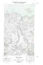
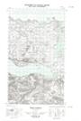
Maps showing Main River Barrens, Eagle River, Newfoundland and Labrador
Main River Barrens is a Low vegetation located in Eagle River, Newfoundland and Labrador.
- Latitude: 54° 4' 38'' North (decimal: 54.0772986)
- Longitude: 57° 51' 11'' West (decimal: -57.8529500)
- Topography Feature Category: Low vegetation
- Geographical Feature: Barrens
- Canadian Province/Territory: Newfoundland and Labrador
- Location: Eagle River
- Atlas of Canada Locator Map: Main River Barrens
- GPS Coordinate Locator Map: Main River Barrens Lat/Long
Main River Barrens NTS Map Sheets