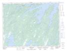
Maps showing Side Pond, Green Bay, Newfoundland and Labrador
Side Pond is a Lake located in Green Bay, Newfoundland and Labrador.
- Latitude: 49° 24' 13'' North (decimal: 49.4036111)
- Longitude: 55° 57' 41'' West (decimal: -55.9613888)
- Topography Feature Category: Lake
- Geographical Feature: Pond
- Canadian Province/Territory: Newfoundland and Labrador
- Location: Green Bay
- Atlas of Canada Locator Map: Side Pond
- GPS Coordinate Locator Map: Side Pond Lat/Long
Side Pond NTS Map Sheets