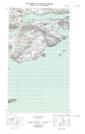
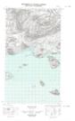
Maps showing Stag Hill, Torngat Mountains, Newfoundland and Labrador
Stag Hill is a Mountain located in Torngat Mountains, Newfoundland and Labrador.
- Latitude: 54° 25' 49'' North (decimal: 54.4301822)
- Longitude: 57° 31' 23'' West (decimal: -57.5229705)
- Topography Feature Category: Mountain
- Geographical Feature: Hill
- Canadian Province/Territory: Newfoundland and Labrador
- Location: Torngat Mountains
- Atlas of Canada Locator Map: Stag Hill
- GPS Coordinate Locator Map: Stag Hill Lat/Long
Stag Hill NTS Map Sheets