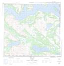
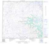
Maps showing Umiakoviagusek Lake, Torngat Mountains, Newfoundland and Labrador
Umiakoviagusek Lake is a Lake located in Torngat Mountains, Newfoundland and Labrador and has an elevation of 22 meters.
- Latitude: 57° 18' 26'' North (decimal: 57.3072639)
- Longitude: 62° 25' 20'' West (decimal: -62.4222805)
- Topography Feature Category: Lake
- Geographical Feature: Lake
- Canadian Province/Territory: Newfoundland and Labrador
- Elevation: 22 meters
- Location: Torngat Mountains
- Atlas of Canada Locator Map: Umiakoviagusek Lake
- GPS Coordinate Locator Map: Umiakoviagusek Lake Lat/Long
Umiakoviagusek Lake NTS Map Sheets