Maps showing Second Pond, Newfoundland and Labrador
Second Pond is a Lake located in Newfoundland and Labrador and has an elevation of 193 meters.
- Latitude: 48° 56' 18'' North (decimal: 48.9382299)
- Longitude: 58° 0' 23'' West (decimal: -58.0062700)
- Topography Feature Category: Lake
- Geographical Feature: Pond
- Canadian Province/Territory: Newfoundland and Labrador
- Elevation: 193 meters
- Atlas of Canada Locator Map: Second Pond
- GPS Coordinate Locator Map: Second Pond Lat/Long
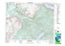
Second Pond NTS Map Sheets