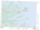
Maps showing Shag Islet, Newfoundland and Labrador
Shag Islet is a Island located in Newfoundland and Labrador and has an elevation of 5 meters.
- Latitude: 48° 36' 7'' North (decimal: 48.6019444)
- Longitude: 53° 49' 00'' West (decimal: -53.8166666)
- Topography Feature Category: Island
- Geographical Feature: Islet
- Canadian Province/Territory: Newfoundland and Labrador
- Elevation: 5 meters
- Atlas of Canada Locator Map: Shag Islet
- GPS Coordinate Locator Map: Shag Islet Lat/Long