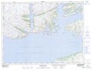
Maps showing Shallop Cove, Newfoundland and Labrador
Shallop Cove is a Bay located in Newfoundland and Labrador and has an elevation of 16 meters.
- Latitude: 47° 39' 33'' North (decimal: 47.6591666)
- Longitude: 56° 10' 1'' West (decimal: -56.1669444)
- Topography Feature Category: Bay
- Geographical Feature: Cove
- Canadian Province/Territory: Newfoundland and Labrador
- Elevation: 16 meters
- Atlas of Canada Locator Map: Shallop Cove
- GPS Coordinate Locator Map: Shallop Cove Lat/Long