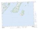
Maps showing Shalloway Point, Newfoundland and Labrador
Shalloway Point is a Cape located in Newfoundland and Labrador and has an elevation of 1 meters.
- Latitude: 47° 16' 49'' North (decimal: 47.2802777)
- Longitude: 54° 0' 18'' West (decimal: -54.0049999)
- Topography Feature Category: Cape
- Geographical Feature: Point
- Canadian Province/Territory: Newfoundland and Labrador
- Elevation: 1 meters
- Atlas of Canada Locator Map: Shalloway Point
- GPS Coordinate Locator Map: Shalloway Point Lat/Long
Shalloway Point NTS Map Sheets