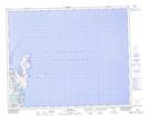
Maps showing Sheep Channel, Newfoundland and Labrador
Sheep Channel is a Channel located in Newfoundland and Labrador and has an elevation of 1 meters.
- Latitude: 51° 37' 16'' North (decimal: 51.6211111)
- Longitude: 55° 25' 18'' West (decimal: -55.4216666)
- Topography Feature Category: Channel
- Geographical Feature: Channel
- Canadian Province/Territory: Newfoundland and Labrador
- Elevation: 1 meters
- Atlas of Canada Locator Map: Sheep Channel
- GPS Coordinate Locator Map: Sheep Channel Lat/Long