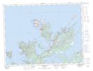
Maps showing Ship Island, Newfoundland and Labrador
Ship Island is a Unincorporated area located in Newfoundland and Labrador and has an elevation of 6 meters.
- Latitude: 49° 38' 25'' North (decimal: 49.6402777)
- Longitude: 54° 36' 42'' West (decimal: -54.6116666)
- Topography Feature Category: Unincorporated area
- Geographical Feature: Settlement
- Canadian Province/Territory: Newfoundland and Labrador
- Elevation: 6 meters
- Atlas of Canada Locator Map: Ship Island
- GPS Coordinate Locator Map: Ship Island Lat/Long
Ship Island NTS Map Sheets