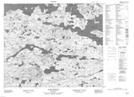
Maps showing Scout Hill, Newfoundland and Labrador
Scout Hill is a Mountain located in Newfoundland and Labrador.
- Latitude: 53° 41' 21'' North (decimal: 53.6892145)
- Longitude: 56° 59' 26'' West (decimal: -56.9904510)
- Topography Feature Category: Mountain
- Geographical Feature: Hill
- Canadian Province/Territory: Newfoundland and Labrador
- Atlas of Canada Locator Map: Scout Hill
- GPS Coordinate Locator Map: Scout Hill Lat/Long
Scout Hill NTS Map Sheets