Maps showing Old Billy, Newfoundland and Labrador
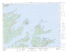
Old Billy is a Shoal located in Newfoundland and Labrador.
- Latitude: 49° 41' 18'' North (decimal: 49.6882808)
- Longitude: 55° 53' 30'' West (decimal: -55.8915919)
- Topography Feature Category: Shoal
- Geographical Feature: Rocks
- Canadian Province/Territory: Newfoundland and Labrador
- Atlas of Canada Locator Map: Old Billy
- GPS Coordinate Locator Map: Old Billy Lat/Long
Old Billy NTS Map Sheets