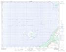
Maps showing O'Rourke Shoal, Newfoundland and Labrador
O'Rourke Shoal is a Shoal located in Newfoundland and Labrador.
- Latitude: 50° 47' 00'' North (decimal: 50.7833333)
- Longitude: 57° 17' 8'' West (decimal: -57.2855555)
- Topography Feature Category: Shoal
- Geographical Feature: Shoal
- Canadian Province/Territory: Newfoundland and Labrador
- Atlas of Canada Locator Map: O'Rourke Shoal
- GPS Coordinate Locator Map: O'Rourke Shoal Lat/Long
O'Rourke Shoal NTS Map Sheets