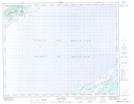
Maps showing Teapot Rock, Newfoundland and Labrador
Teapot Rock is a Shoal located in Newfoundland and Labrador.
- Latitude: 51° 41' 57'' North (decimal: 51.6991666)
- Longitude: 56° 27' 56'' West (decimal: -56.4655555)
- Topography Feature Category: Shoal
- Geographical Feature: Rock
- Canadian Province/Territory: Newfoundland and Labrador
- Atlas of Canada Locator Map: Teapot Rock
- GPS Coordinate Locator Map: Teapot Rock Lat/Long
Teapot Rock NTS Map Sheets