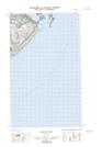
Maps showing Temple Pass, Eagle River, Newfoundland and Labrador
Temple Pass is a Channel located in Eagle River, Newfoundland and Labrador.
- Latitude: 51° 59' 1'' North (decimal: 51.9835926)
- Longitude: 55° 53' 38'' West (decimal: -55.8939231)
- Topography Feature Category: Channel
- Geographical Feature: Pass
- Canadian Province/Territory: Newfoundland and Labrador
- Location: Eagle River
- Atlas of Canada Locator Map: Temple Pass
- GPS Coordinate Locator Map: Temple Pass Lat/Long
Temple Pass NTS Map Sheets