Canada Topographic Maps

Lily Islands Topo Maps

Topography maps and Latitude/Longitude Location

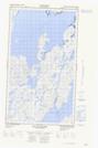
Maps showing Lily Islands, Newfoundland and Labrador

Lily Islands is a Island located in Newfoundland and Labrador.

  • Latitude: 55° 16' 00'' North   (decimal: 55.2666666)
  • Longitude: 59° 41' 57'' West   (decimal: -59.6991666)
  • Topography Feature Category: Island
  • Geographical Feature: Islands
  • Canadian Province/Territory: Newfoundland and Labrador
  • GPS Coordinate Locator Map: Lily Islands Lat/Long

Lily Islands NTS Map Sheets

013O04E Bay Of Islands Topographic Map at 1:50,000 scale

013O04W Bay Of Islands Topographic Map at 1:50,000 scale

013O05E Double Islands Topographic Map at 1:50,000 scale

013O05W Double Islands Topographic Map at 1:50,000 scale

013O Makkovik Topographic Map at 1:250,000 scale

 
Buy Topographic Maps DVD
Newsletter Sign-up

Yes, I want to receive map store discounts.


Bookmark and Share