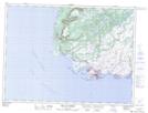
Maps showing Big Woody Island, La Poile, Newfoundland and Labrador
Big Woody Island is a Island located in La Poile, Newfoundland and Labrador and has an elevation of 6 meters.
- Latitude: 47° 34' 43'' North (decimal: 47.5786111)
- Longitude: 59° 0' 28'' West (decimal: -59.0077777)
- Topography Feature Category: Island
- Geographical Feature: Island
- Canadian Province/Territory: Newfoundland and Labrador
- Elevation: 6 meters
- Location: La Poile
- Atlas of Canada Locator Map: Big Woody Island
- GPS Coordinate Locator Map: Big Woody Island Lat/Long
Big Woody Island NTS Map Sheets