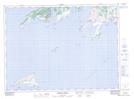
Maps showing Bank O'North Shoal, Newfoundland and Labrador
Bank O'North Shoal is a Shoal located in Newfoundland and Labrador.
- Latitude: 47° 23' 6'' North (decimal: 47.3850000)
- Longitude: 55° 45' 7'' West (decimal: -55.7519444)
- Topography Feature Category: Shoal
- Geographical Feature: Shoal
- Canadian Province/Territory: Newfoundland and Labrador
- Atlas of Canada Locator Map: Bank O'North Shoal
- GPS Coordinate Locator Map: Bank O'North Shoal Lat/Long
Bank O'North Shoal NTS Map Sheets