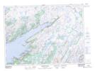
Maps showing Boat Rocks, Newfoundland and Labrador
Boat Rocks is a Shoal located in Newfoundland and Labrador.
- Latitude: 47° 34' 00'' North (decimal: 47.5666666)
- Longitude: 54° 52' 57'' West (decimal: -54.8824998)
- Topography Feature Category: Shoal
- Geographical Feature: Rocks
- Canadian Province/Territory: Newfoundland and Labrador
- Atlas of Canada Locator Map: Boat Rocks
- GPS Coordinate Locator Map: Boat Rocks Lat/Long
Boat Rocks NTS Map Sheets