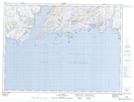
Maps showing Old Man Shoal, Newfoundland and Labrador
Old Man Shoal is a Shoal located in Newfoundland and Labrador.
- Latitude: 47° 39' 45'' North (decimal: 47.6626216)
- Longitude: 58° 9' 4'' West (decimal: -58.1511072)
- Topography Feature Category: Shoal
- Geographical Feature: Shoal
- Canadian Province/Territory: Newfoundland and Labrador
- Atlas of Canada Locator Map: Old Man Shoal
- GPS Coordinate Locator Map: Old Man Shoal Lat/Long
Old Man Shoal NTS Map Sheets