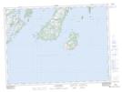
Maps showing Rocky Cove Sunker, Newfoundland and Labrador
Rocky Cove Sunker is a Shoal located in Newfoundland and Labrador and has an elevation of 15 meters.
- Latitude: 47° 26' 43'' North (decimal: 47.4452777)
- Longitude: 54° 24' 34'' West (decimal: -54.4094444)
- Topography Feature Category: Shoal
- Geographical Feature: Sunker
- Canadian Province/Territory: Newfoundland and Labrador
- Elevation: 15 meters
- Atlas of Canada Locator Map: Rocky Cove Sunker
- GPS Coordinate Locator Map: Rocky Cove Sunker Lat/Long
Rocky Cove Sunker NTS Map Sheets