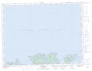
Maps showing Fortune Harbour, Exploits, Newfoundland and Labrador
Fortune Harbour is a Unincorporated area located in Exploits, Newfoundland and Labrador and has an elevation of 26 meters.
- Latitude: 49° 30' 34'' North (decimal: 49.5094444)
- Longitude: 55° 14' 16'' West (decimal: -55.2377777)
- Topography Feature Category: Unincorporated area
- Geographical Feature: Settlement
- Canadian Province/Territory: Newfoundland and Labrador
- Elevation: 26 meters
- Location: Exploits
- Atlas of Canada Locator Map: Fortune Harbour
- GPS Coordinate Locator Map: Fortune Harbour Lat/Long