Maps showing The Rubbles, Newfoundland and Labrador
The Rubbles is a Mountain located in Newfoundland and Labrador.
- Latitude: 47° 29' 13'' North (decimal: 47.4869444)
- Longitude: 55° 1' 13'' West (decimal: -55.0202777)
- Topography Feature Category: Mountain
- Geographical Feature: Hills
- Canadian Province/Territory: Newfoundland and Labrador
- Atlas of Canada Locator Map: The Rubbles
- GPS Coordinate Locator Map: The Rubbles Lat/Long
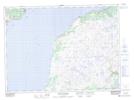
The Rubbles NTS Map Sheets